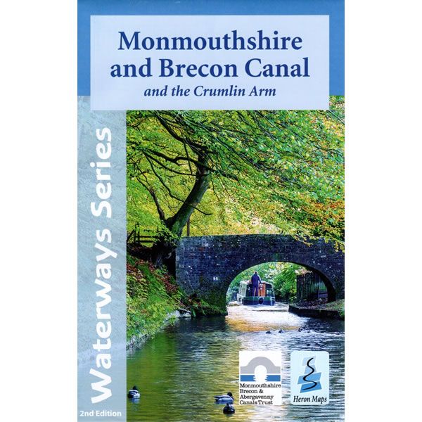
Monmouthshire and Brecon Canal Heron Map
This Heron waterways map covers the Monmouthshire and Brecon Canal, including the Crumlin branch. The map provides detailed information for both waterways and leisure users, and it is complimented by information panels and photographs.
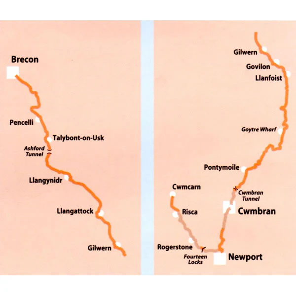
Much of the navigable Monmouthshire and Brecon Canal flows through the stunning scenery of the Brecon Beacons National Park offering views of rugged green hillsides, dense woodlands and wild moors in a largely rural and tranquil setting. The canal towpath offers both walkers and cyclists a wonderful way to explore the area. Whilst the canal is not part of the main waterways network, there are several hire companies based here offering holiday makers the opportunity to cruise this beautiful waterway.
This cruising and tourist map of the Monmouthshire and Brecon Canal is at a scale of 1:45,000. There are detailed town plans of Brecon, Talybont-on-Usk and Gilwern at a scale of 1:12,500.
The map includes navigation and historical information, visitor moorings, marinas and boatyards, boat hire centres, facilities for the boat user, shops, post offices and distance markers. Information for the tourist includes tourist information centres, places of interest, bicycle hire, canoe hire points, pubs, nature reserves, parks, churches, long distance paths, public toilets, hostels and caravan and camp sites.
Published by Heron Maps in 2021 (revised 2nd edition).
Scale is 1:45,000.
ISBN is 9781908851284.
More Images
Monmouthshire and Brecon Canal Heron Map
This Heron waterways map covers the Monmouthshire and Brecon Canal, including the Crumlin branch. The map provides detailed information for both waterways and leisure users, and it is complimented by information panels and photographs.
Much of the navigable Monmouthshire and Brecon Canal flows through the stunning scenery of the Brecon Beacons National Park offering views of rugged green hillsides, dense woodlands and wild moors in a largely rural and tranquil setting. The canal towpath offers both walkers and cyclists a wonderful way to explore the area. Whilst the canal is not part of the main waterways network, there are several hire companies based here offering holiday makers the opportunity to cruise this beautiful waterway.
This cruising and tourist map of the Monmouthshire and Brecon Canal is at a scale of 1:45,000. There are detailed town plans of Brecon, Talybont-on-Usk and Gilwern at a scale of 1:12,500.
The map includes navigation and historical information, visitor moorings, marinas and boatyards, boat hire centres, facilities for the boat user, shops, post offices and distance markers. Information for the tourist includes tourist information centres, places of interest, bicycle hire, canoe hire points, pubs, nature reserves, parks, churches, long distance paths, public toilets, hostels and caravan and camp sites.
Published by Heron Maps in 2021 (revised 2nd edition).
Scale is 1:45,000.
ISBN is 9781908851284.
Product Information
Product Information
Shipping & Returns
Shipping & Returns
Description
This Heron waterways map covers the Monmouthshire and Brecon Canal, including the Crumlin branch. The map provides detailed information for both waterways and leisure users, and it is complimented by information panels and photographs.
Much of the navigable Monmouthshire and Brecon Canal flows through the stunning scenery of the Brecon Beacons National Park offering views of rugged green hillsides, dense woodlands and wild moors in a largely rural and tranquil setting. The canal towpath offers both walkers and cyclists a wonderful way to explore the area. Whilst the canal is not part of the main waterways network, there are several hire companies based here offering holiday makers the opportunity to cruise this beautiful waterway.
This cruising and tourist map of the Monmouthshire and Brecon Canal is at a scale of 1:45,000. There are detailed town plans of Brecon, Talybont-on-Usk and Gilwern at a scale of 1:12,500.
The map includes navigation and historical information, visitor moorings, marinas and boatyards, boat hire centres, facilities for the boat user, shops, post offices and distance markers. Information for the tourist includes tourist information centres, places of interest, bicycle hire, canoe hire points, pubs, nature reserves, parks, churches, long distance paths, public toilets, hostels and caravan and camp sites.
Published by Heron Maps in 2021 (revised 2nd edition).
Scale is 1:45,000.
ISBN is 9781908851284.


